
Andrew Shaw
REALTOR® · REAL Broker · The Ellis Team
(506) 650-1242
andrew@andrewdshaw.ca
andrew.agentrunway.ca

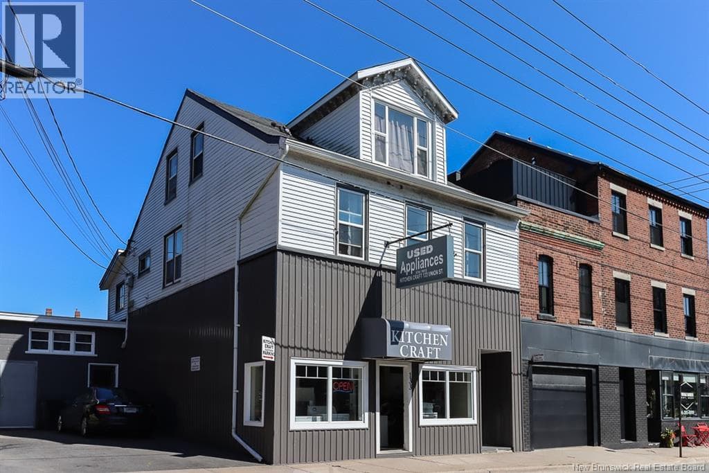
Other · Saint John
$499,900
133 Union Street
Saint John, New Brunswick E2L 1A6
2,532 square feet357 square meters lot
- MLS®
- NB123827
- PID
- 00037317
- Status
- Active
- Listed
- August 11, 2025 (445 days)
- Ownership
- Freehold
Scan for every photograph, the map and the current price
Key points
- Main level has commercial space with off-street parking
- Unit 1: two-level, 4-bedroom apartment with updated bathroom
- Unit 1 has in-unit laundry and large kitchen
- Unit 2: 2-bedroom, 1-bathroom apartment
- Property located in Uptown Saint John
Drawn from the listing description; the full text is on the listing page named in the footer.
The details
- Property type
- Other
- Living area
- 2,532 square feet
- Lot size
- 357 square meters
- Lot features
- Visual exposure
- Exterior features
- Vinyl
- Heating
- Oil
Assessment and taxes
- Assessed value (2026)
- $230,700
- Property tax levy (2026)
- $6,334.68
From the province’s assessment record for this parcel. An assessed value is not a market value, and the levy is the current owner’s bill; a new owner’s can differ. Contains information licensed under the Open Government Licence - New Brunswick.
Around this home
- Schools
- Prince Charles School630 m · grades K-8 · English
- St. Malachy's Memorial High School430 m · grades 9-12 · English, French Immersion · Grade 9 entry by preference, not by zone
- Centre scolaire Samuel-de-Champlain4.8 km · grades K-12 · French
Catchments are set by the district. Confirm a home's school with Anglophone South (asdsbp.nbed.nb.ca/Eligibility) or District scolaire francophone Sud (dsfsbp.nbed.nb.ca/Eligibility).
- Sold nearby
- 47 homes changed hands within 1 kmtransfers registered 30 October 2025 to 29 September 2026
- Median price $335,000middle half $273,000 to $435,000
- Median 6% above assessed valuemiddle half 3% below to 25% above
The province's recorded transfers, not MLS sales; a parcel counts once, at its latest transfer, and the figures are for the area, not this home.
Contains information licensed under the Open Government Licence – New Brunswick.
Checked 22 September 2026 to 30 October 2026