

A Saint John novel
The Boar’s Head Blade.
I’ve written a historical adventure novel set entirely in Saint John. Not a book with the city painted in behind it. One where the river, the tide and the harbour are the machinery the story runs on. Lift it out of here and put it anywhere else and the plot stops working.
A short prologue in 1604. The rest in 1971 and 1972, when a handful of local teenagers pull on a thread of real regional history that has been sitting in plain sight, unexamined, for more than 350 years.
An early look
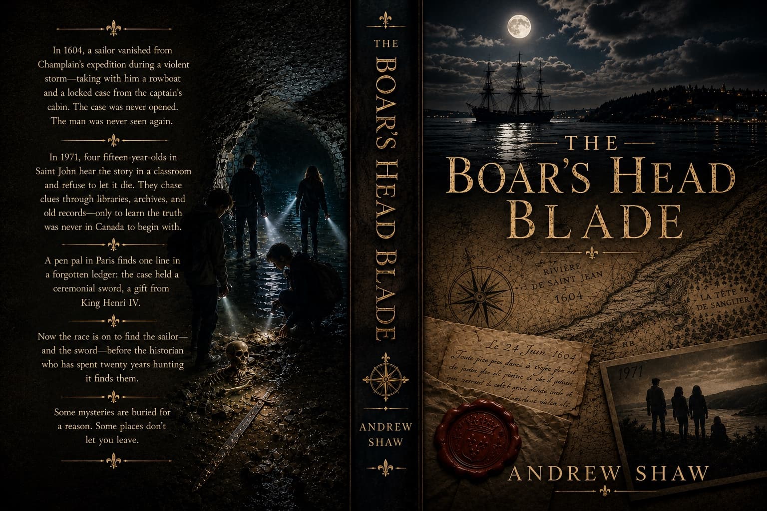
The cover, ahead of publication.
01The tide is a clock
Twice a day, on a schedule you can set a watch to.
The Bay of Fundy has the highest tides on earth. People quote fifty feet, and that number is real, but it belongs to Burntcoat Head up in the Minas Basin, two hundred kilometres away at the top of the bay. Here at the mouth, Saint John runs to about 8.6 metres. Call it twenty-eight feet of water, arriving and leaving twice every day.
Twenty-eight feet is still enormous. It is enough to lift a working harbour, drain it, and fill it again before supper. In the novel the climax happens inside a tidal cave, which means the tide stops being scenery and starts being a countdown. The characters are not fighting a villain so much as a timetable.
The cave is invented. The timetable is not. That is the part I could not have made up anywhere but here.
02A river that runs backwards
The Reversing Falls only happen in one place.
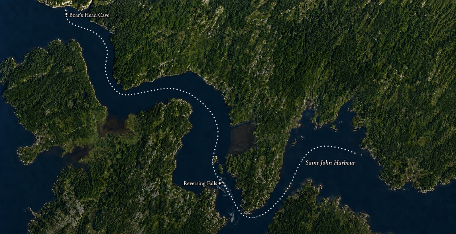
Where the river narrows through a rocky gorge just above the harbour, the tide does something the river cannot argue with. Twice a day, the incoming tide rises higher than the river itself, and for a period the current physically reverses. Water that spends the rest of the day flowing out to sea gets forced back upstream through the gorge instead.
Most people, myself included for most of my life, call it the Reversing Falls. It is not really a waterfall. There is no cliff for the water to drop over, only a series of underwater ledges that turn the tide into rapids and whirlpools. Saint John’s own tourism board has been quietly correcting the record: the official name today is the Reversing Falls Rapids, and you will increasingly hear it called the Reversing Rapids and nothing else.
Between the two directions there is a short window, slack tide, where the water goes nearly flat and calm. For a few minutes, twice a day, it is the only safe way to get a small boat through the gorge. I did not invent that for the plot. Champlain wrote about the very same passage in 1604: “by waiting till high tide you can pass this fall very easily.” Three and a half centuries later, it is also how a rowboat gets through the same gorge in the opening pages of my own book.
Go see it yourself
Reversing Falls
The gorge, from either bank
Boars Head
Upriver, southern end of the Kennebecasis
Saint John Harbour
Where the 1604 ships came in
Ragged Point
Millidgeville, on the water
Every one of these is a real place on the map, and every one of them is in the book.
0324 June 1604
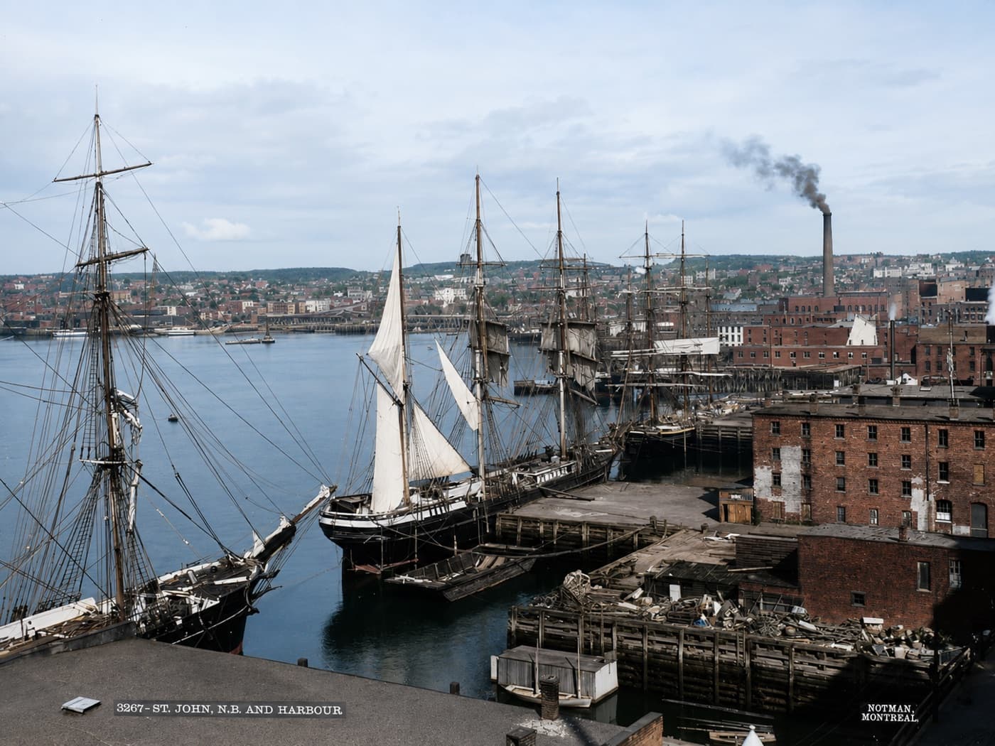
They sailed in on the feast of Saint John the Baptist, and named the river after the day.
The expedition was led by Pierre Dugua, Sieur de Mons, under a commission from Henri IV. Champlain was aboard as geographer and mapmaker, holding no command, which is a detail most retellings quietly drop. They anchored in this harbour and put a name on the river that stuck for four centuries.
Then the gorge stopped them. Champlain described it in his own account: a fall between two cliffs where the water ran so hard that “a piece of wood thrown in is drawn under and not seen again.” They waited for a better tide, got through, and went a little farther. Then, in his own words: “We did not explore it farther up.”
That is where the novel lives. Not in a contradiction of the record, but in the gap it leaves open. Champlain’s own account says exactly how far he went, and no farther. My fictional escape, three and a half centuries later, goes on past that point, into water the real record simply never describes.
04Keeping it honest
What is real history, and what I made up.
The book is fiction built on top of real geography and one real, thinly documented voyage. I would rather be plain about which is which than have a good story blur somebody’s sense of what actually happened here.
Real, and verifiable
- Champlain’s arrival in Saint John harbour on 24 June 1604
- Pierre Dugua, Sieur de Mons, leading that expedition under a commission from Henri IV
- The naming of the Saint John River for the saint’s day
- The Reversing Falls, and the tide that drives them
- The Bay of Fundy’s tidal extremes
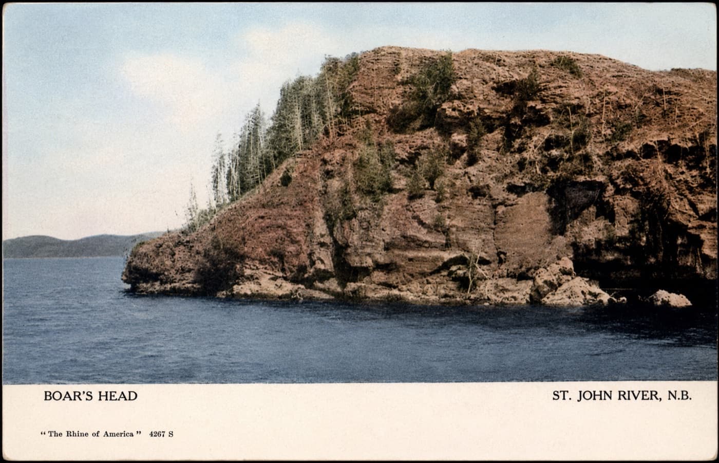
- Boars Head, an actual headland on the river
Invented for the novel
- The blade the book is named for
- The sailor who takes it
- The cave it ends up in
- Every historical document named in the story
- Every character, in both 1604 and 1971
None of this is Saint John history. It is a story I built around the parts that are.
Champlain’s words above are quoted from the standard published English translation of his own journals. The official naming of the Reversing Falls Rapids reflects current usage by Saint John’s tourism board.
05Why this is on a real estate site
Same river. Same tide. Same shoreline.
The 1971 half of the book moves through Millidgeville, Ragged Point, and the reaches up toward Grand Bay and the Kennebecasis. Those are not exotic locations I researched. That is my Saturday.
I spend my working life helping people buy and sell houses along this water, and my spare hours on a novel whose plot only functions because of how that water behaves. Both jobs come from the same place. I find this stretch of coastline genuinely interesting, and I have for as long as I can remember.
If you want somebody who knows the tide tables and the old place names before they know your budget, that is the argument I would make for myself.
The Boar’s Head Blade is finished. When there’s something to read, it will show up here first.