
Restored archives
Saint John, then.
I collect old photographs of this city and put colour and clarity into them. Horses working the mud at Market Slip. The harbour still full of masts. A band playing to half of King Square. These are the same streets and shorelines I sell homes on today, which is most of the reason I can’t leave them alone.
King Square · circa 1910
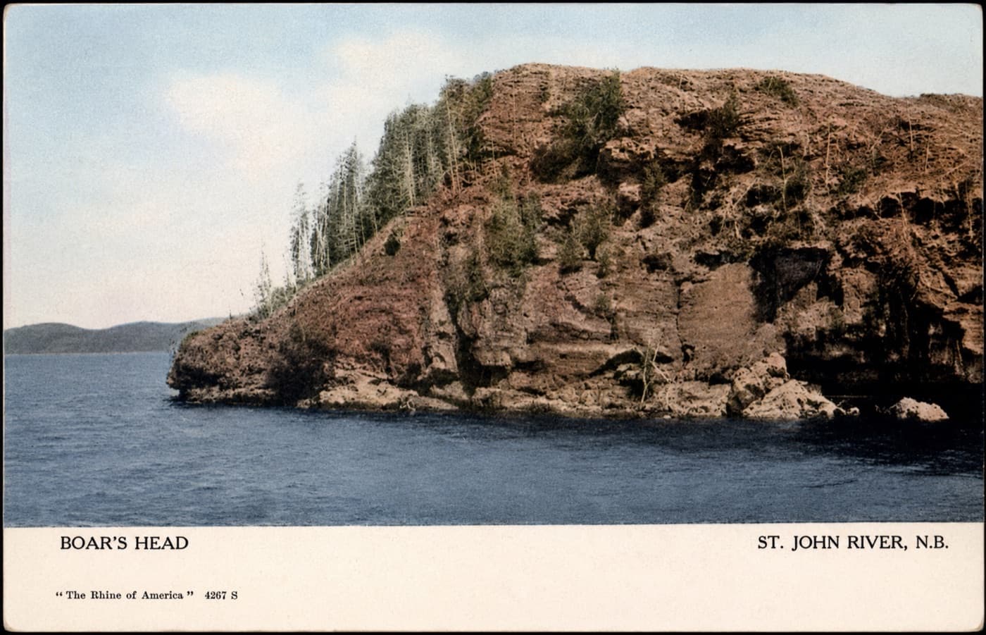
Boar’s Head
The rock face that gives Boar’s Head its name, rising straight out of the river below Millidgeville. The postcard publisher gave the river a grander billing than locals ever did.
Circa 1906
Millidgeville, on the Saint John River
“Boar’s Head · St. John River, N.B. · The Rhine of America”
I’ve written a novel named after this headland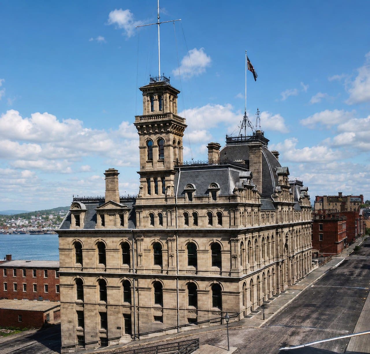
The Custom House
Three storeys on Prince William Street and five down the hill on Water Street, with the harbour behind it. A ball dropped from the tower at noon so ships could set their chronometers by it. A fire in 1893 left the sandstone porous, and by 1960 the federal government pulled the whole thing down rather than repair it. The rubble was carted off and used as fill along the harbourfront.
Built 1881 · demolished 1960
Prince William Street at Water Street, uptown
Some of the stone ended up out at Taylors Island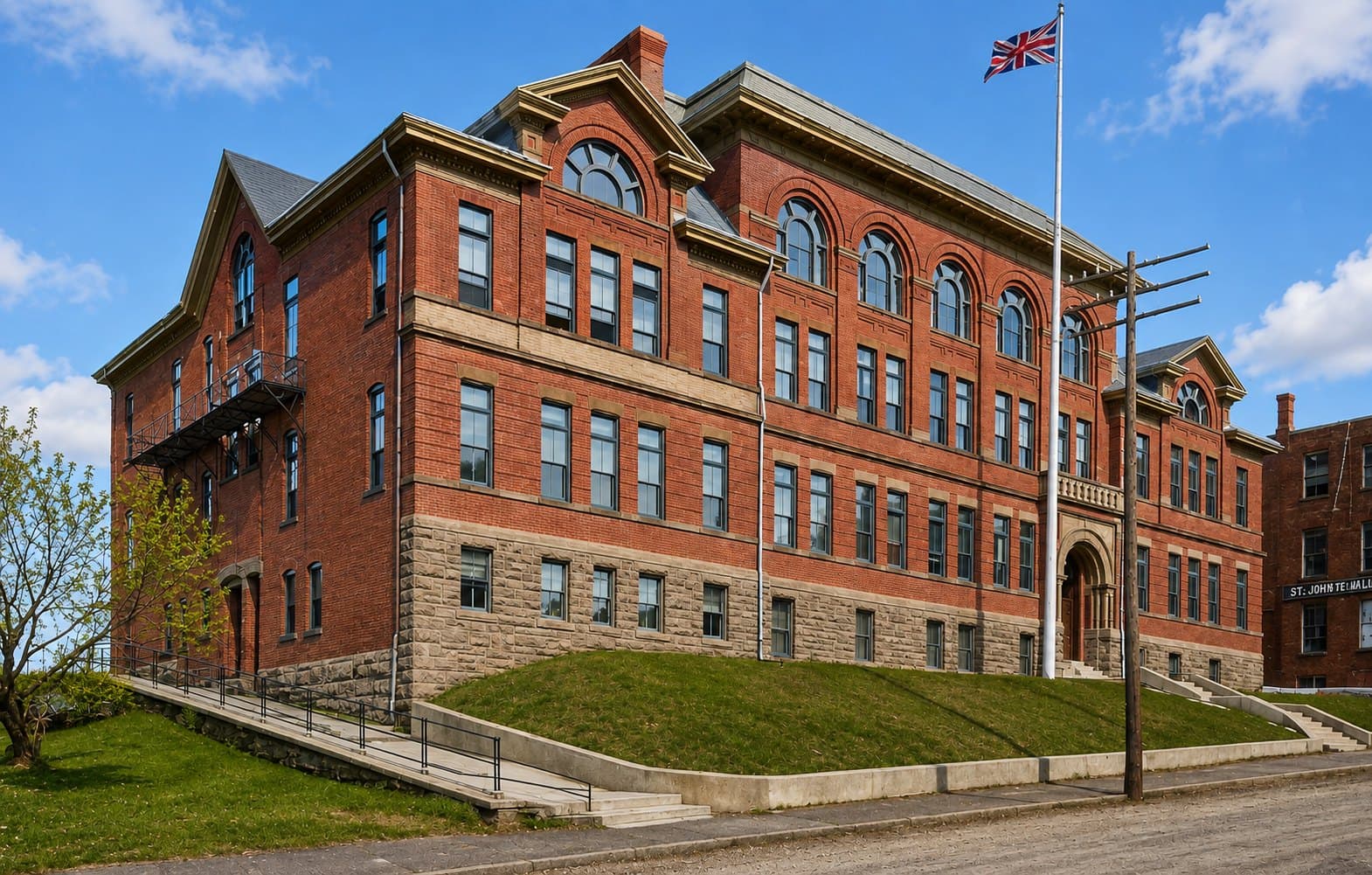
Saint John High School
The Union Street school that opened as Saint John High in 1897, putting the boys' and girls' schools into one building for the first time. It held the students until the 1930s, when the school moved to its present home on Prince William Street. Saint John High goes back to 1805 and is the oldest publicly funded school in Canada.
Opened 1897
Union Street, uptown
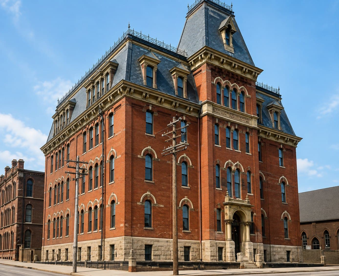
Victoria School
It opened in 1876 and burned in the Great Fire the following June. The rebuild went up on the same corner to a design by John McKean, who also drew City Hall and worked on the Custom House. St. David's church stands alongside it here. The corner is a city parking lot today.
Built 1876 · rebuilt 1877 after the fire
Duke Street at Sydney Street, uptown
McKean's buildings, catalogued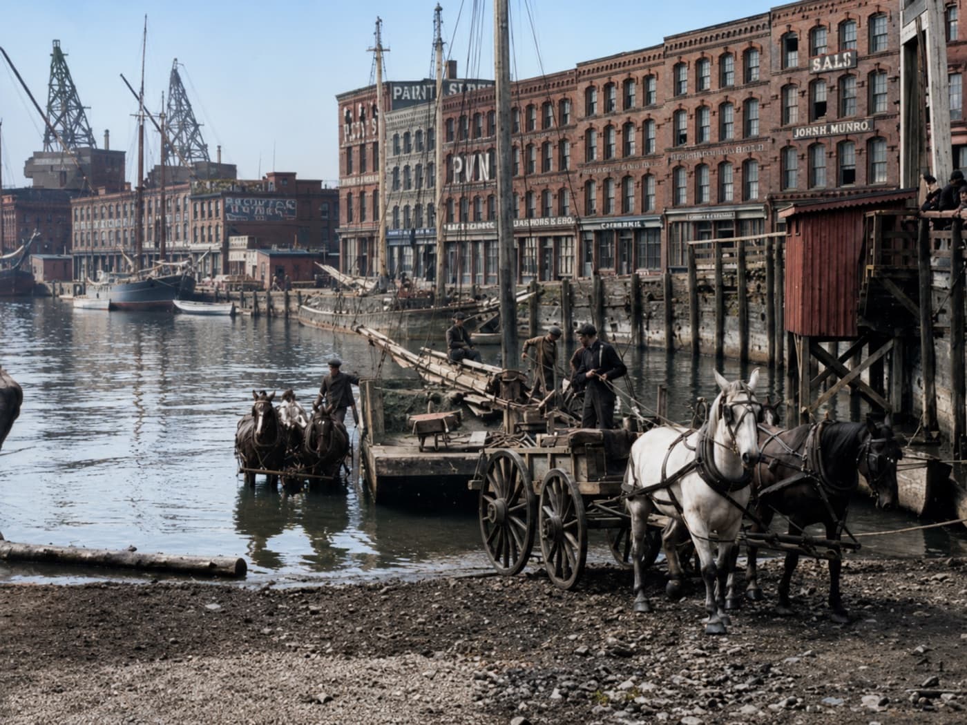
Market Slip at low tide
Teams of horses working the mud at low water, hauling from a scow onto the beach while the warehouses look on. The Bay of Fundy tide has always set the schedule here.
Early 1900s
Market Slip, uptown Saint John
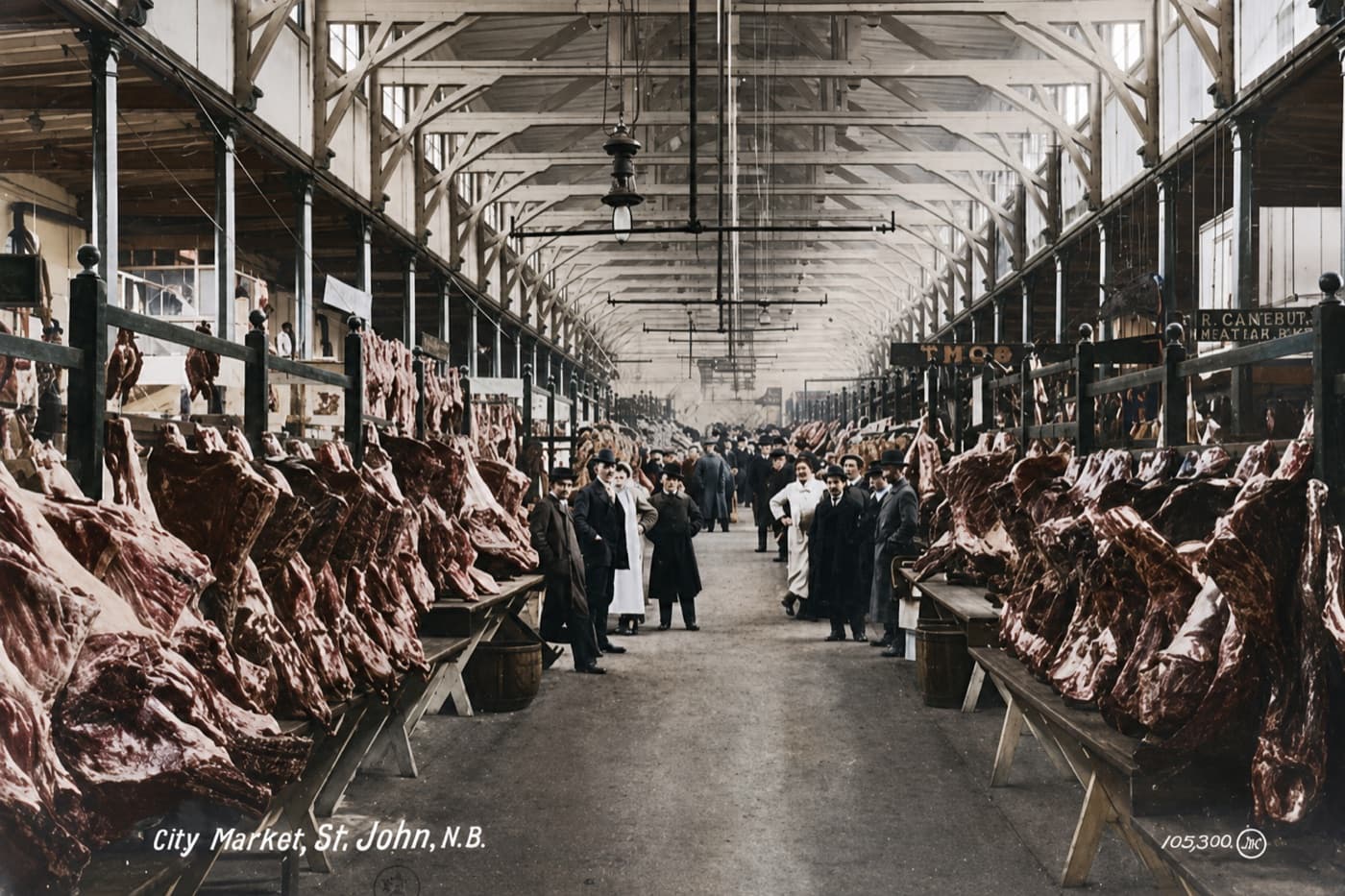
Inside the City Market
Butchers’ stalls running the length of the hall under that timber-framed roof, with the whole market turned to face the camera.
Early 1900s
Charlotte Street, uptown
“City Market, St. John, N.B.”
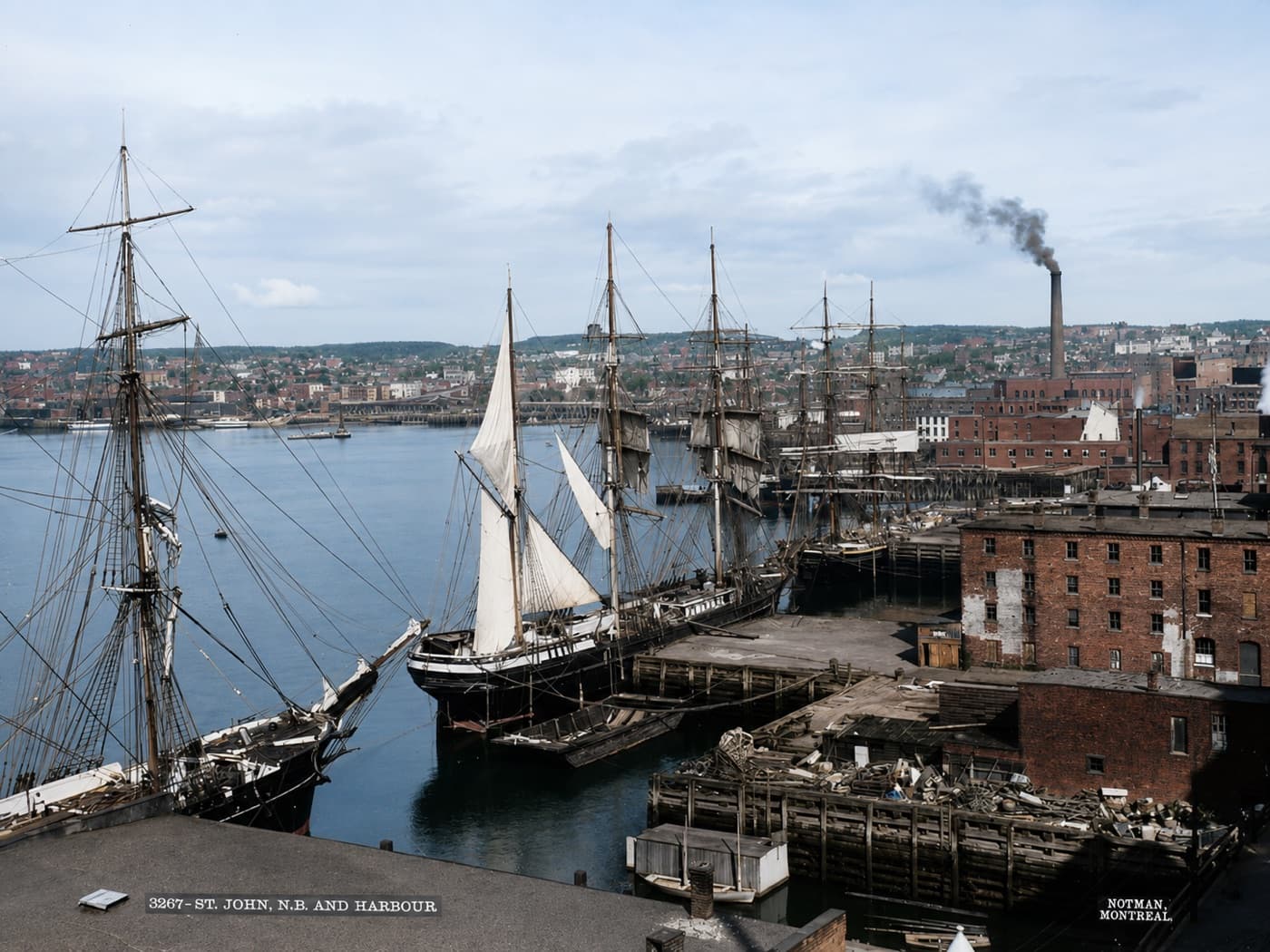
Tall ships in the harbour
Masts crowding the wooden wharves, with the city stacked on the hill behind and a mill stack already smoking. A working harbour, photographed by the Notman studio.
Late 1800s
Saint John Harbour
“3267 · St. John, N.B. and Harbour” · Notman, Montreal
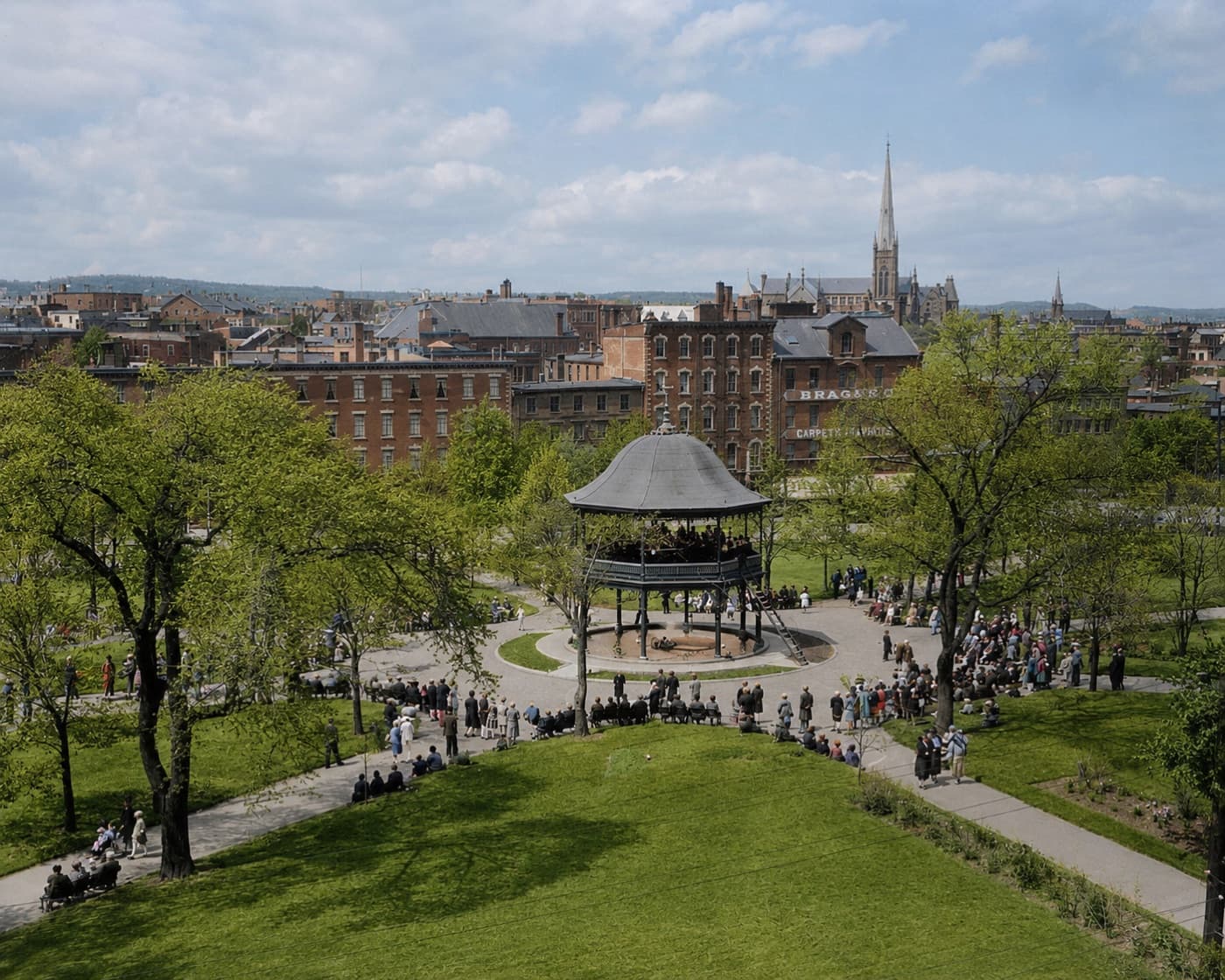
A crowd at the King Square bandstand
Half the square turned out for the band, spilling along the paths under new leaves. Trinity’s spire and the brick blocks of Charlotte Street sit behind.
Circa 1910
King Square, uptown
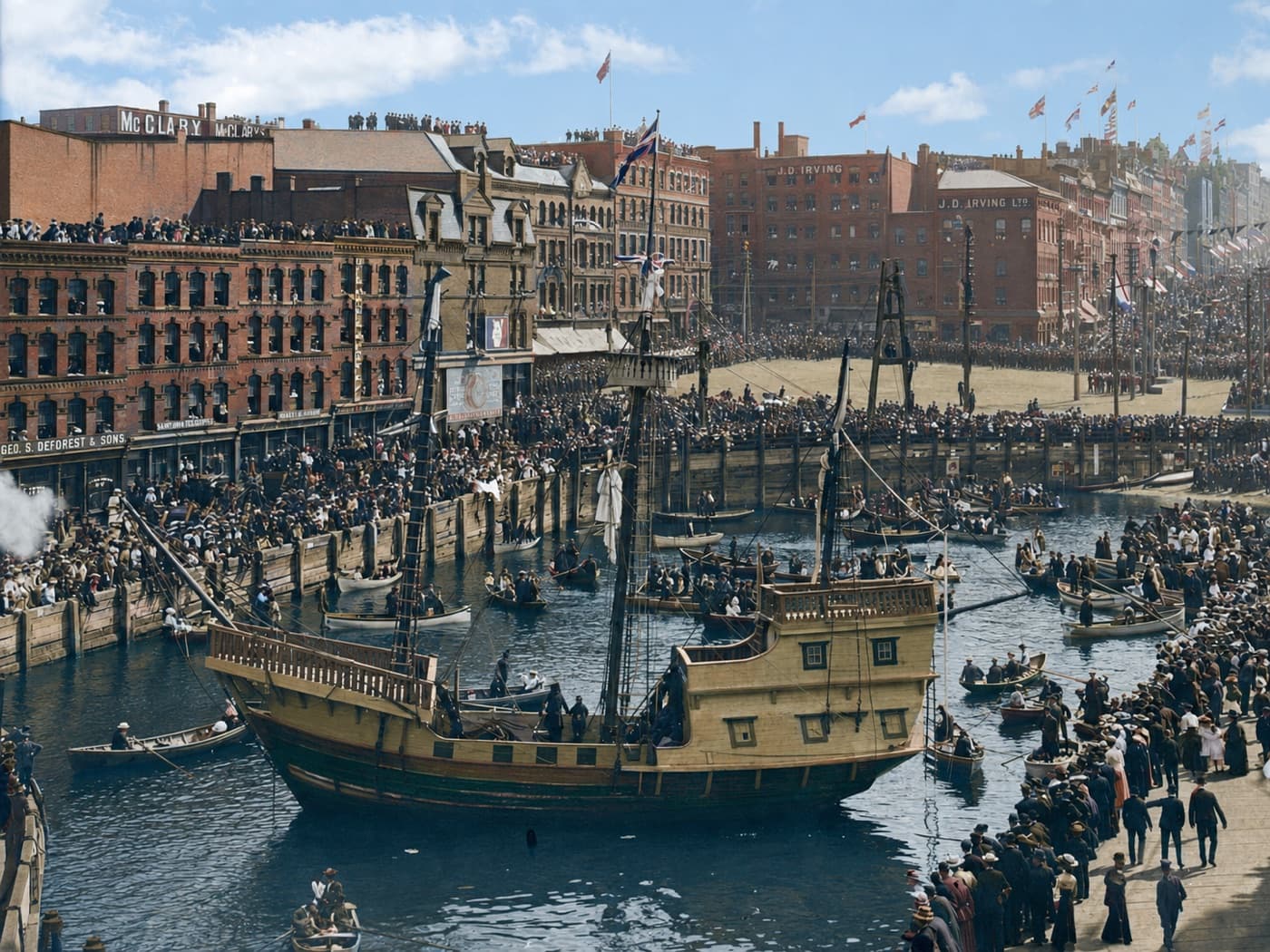
The slip, from the other side
A second look at the same working waterfront, where the boats simply settled into the mud and waited for the water to come back.
Early 1900s
Market Slip, uptown Saint John
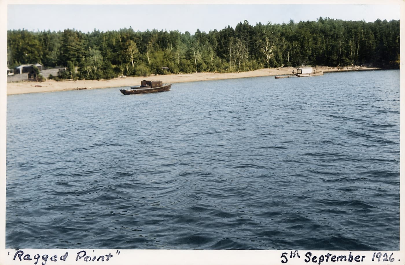
Ragged Point
Somebody dated this one by hand the day it was taken. Boats at anchor off the sand, and nothing behind the beach but trees.
5 September 1926
Ragged Point, Millidgeville
Handwritten on the print: “Ragged Point” · 5th September 1926
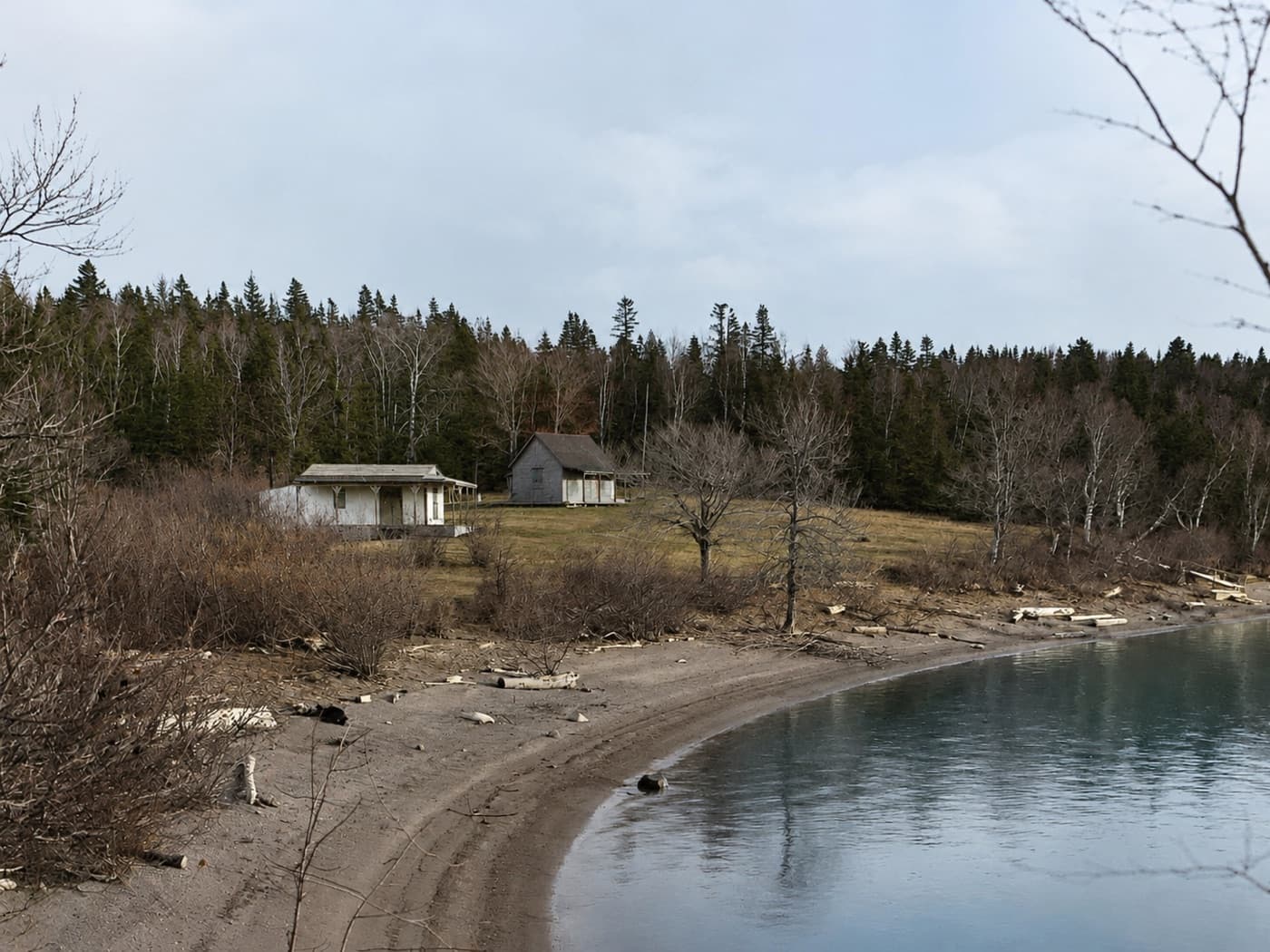
Cottages above the beach
Two cottages on the rise over the curve of the shore, late in the season with the leaves down.
Circa 1925–1930
Ragged Point, Millidgeville
How these were made
These began as black and white prints and negatives. I used software to remove damage and add colour, which means the colours are an interpretation rather than a record: nobody knows what shade that awning really was. The same process fills in detail where the original was soft, and it is confident about it even when it is wrong.
Lettering is where that shows up most. Writing on a sign or carved into stone can come out looking sharp and still be nonsense the camera never saw. So read the words in these images as texture, not as text. Anywhere a date, a place or a publisher appears in a caption, it is written on the original print and quoted from there, not read off the restored version.
Dates marked “circa” are approximate. The underlying photographs are archival; the colour and the repairs are mine.
The city changed. The tide didn’t.
I grew up on these streets and I work on them now. If you’re thinking about buying or selling somewhere with this much behind it, let’s talk.