Andrew Shaw
REALTOR® · REAL Broker · The Ellis Team
(506) 650-1242
andrew@andrewdshaw.ca
andrew.agentrunway.ca

Vacant Land · Quispamsis
$56,000
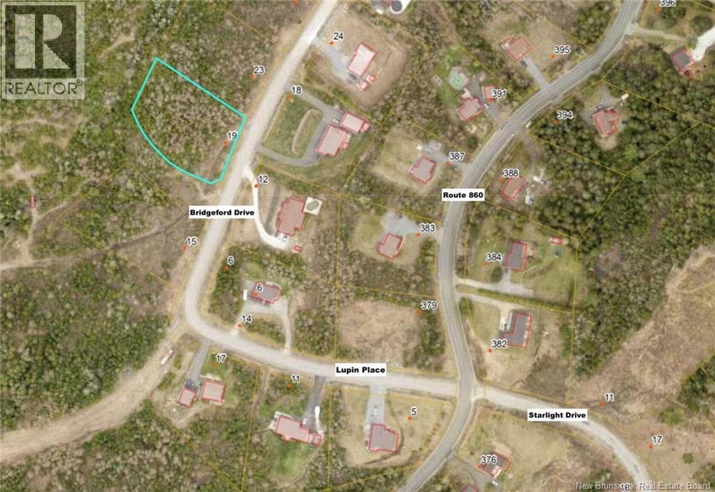
19 Bridgeford Drive
Quispamsis, New Brunswick E2S 0C3
0.98 acres lot
- MLS®
- NB140391
- PID
- 30346621
- Status
- Active
- Listed
- May 26, 2026 (140 days)
- Ownership
- Freehold
Scan for every photograph, the map and the current price
Key points
- Last remaining lot in Covered Bridge Estates, French Village
- Survey complete
- Mature trees on property
- Hammond River nearby for swimming, paddling, tubing, fishing
- Private 1 km trail system with covered bridge for residents
- Bater Brook on property
- ATV, side-by-side and snowmobile trails nearby
Drawn from the listing description; the full text is on the listing page named in the footer.
The details
- Property type
- Vacant Land
- Lot size
- 0.98 acres
- Lot features
- Treed
- Water
- None
- Sewer
- No sewage system
Assessment and taxes
- Assessed value (2026)
- $47,000
- Property tax levy (2026)
- $812.14
From the province’s assessment record for this parcel. An assessed value is not a market value, and the levy is the current owner’s bill; a new owner’s can differ. Contains information licensed under the Open Government Licence - New Brunswick.
Around this home
- Schools
- Quispamsis Elementary School5.1 km · grades K-5 · English, French Immersion
- Quispamsis Middle School5.7 km · grades 6-8 · English, French Immersion
- Kennebecasis Valley High School4.1 km · grades 9-12 · English, French Immersion
- École des Pionniers5.3 km · grades K-5 · French
Catchments are set by the district. Confirm a home's school with Anglophone South (asdsbp.nbed.nb.ca/Eligibility) or District scolaire francophone Sud (dsfsbp.nbed.nb.ca/Eligibility).
- Sold nearby
- 18 homes changed hands within 2 kmtransfers registered 14 October 2025 to 29 September 2026
- Median price $516,000middle half $383,000 to $553,000
- Median 19% above assessed valuemiddle half 2% to 28% above
The province's recorded transfers, not MLS sales; a parcel counts once, at its latest transfer, and the figures are for the area, not this home.
Contains information licensed under the Open Government Licence – New Brunswick.
Checked 22 September 2026 to 14 October 2026